Flagstaff via Gregory Canyon: Beautiful Hike Through Nature
Flagstaff via Gregory Canyon Reading Time: 17 minutes
This blog post is about the Flagstaff summit hike in Boulder, Colorado. This post is not about Flagstaff in Arizona. Many people would consider Flagstaff Mountain to be one of the best hikes in Colorado. It certainly is one of the more well-known hikes near Boulder. In this blog post, I will give you all the details you’ll need to do the hike: where to park, how to find the Gregory Canyon Trailhead, Boulder hiking trail add-ons (if you want more of a challenge), etc.
I use AllTrails Plus when I go hiking. I highly recommend it as you can download offline maps, and send out “lifelines” to friends and family to let them know exactly where you are. You can rate trails, and get inspired to try new ones. The membership is $35/year, but with this discount, it is just $25 for the year. That’s barely $2/month.
Click here to get 30% OFF of your own AllTrails Plus account
Use code: nickiposts30

Boulder Hiking Trail: Flagstaff via Gregory Canyon Boulder
Check out my Flagstaff hiking reel on Instagram.
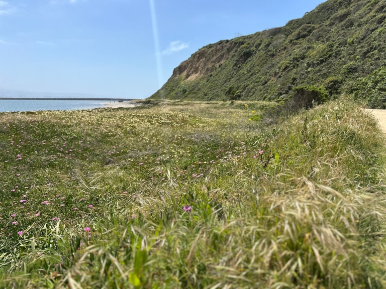
The Flagstaff via Gregory Canyon hike is a great hike through lots of nature and a few decent views near the top. The main downside to this hike is that the “peak” of Flagstaff is in a meadow and doesn’t have a lot of great views. There are very nice views on the way up, but the peak is very anti-climactic. If that doesn’t bother you, then you’ll certainly enjoy this hike. It is definitely one of the more well-known Boulder hiking trails.
This is an out-and-back trail, although you can do a small loop around Flagstaff Mountain from Realization Point.
Must Hike Score:
5/10
The only reason I’m giving a lower score here is because of the mediocre summit views. Although there are some nice views along the Ute Trail leading up to Flagstaff Mountain, as well as along Gregory Canyon.
Where is the Flagstaff via Gregory Canyon Trail?
Click here to see the Flagstaff via Gregory Canyon Map on AllTrails. You can take a virtual Tour of Gregory Canyon if you have an AllTrails+ account.
Flagstaff Mountain is just slightly west of Chautauqua Park. You can reach the Flagstaff via Gregory Canyon Trail by foot from Chautauqua Park via the Baseline Trail, Chautauqua Trail, or the Meadow Trail. You can also find the Gregory Canyon Trailhead by continuing a few minutes along Baseline Road (which turns into Flagstaff Road) and then turning left onto Gregory Canyon Road.
How Much Elevation Gain is the Flagstaff Trail?
The elevation of Flagstaff in Boulder is 6983 feet (2128m). The elevation gain from the parking lot at the Gregory Canyon Trailhead to the summit of Flagstaff Mountain is 1512 feet.
Getting to the Flagstaff Trailhead
Flagstaff via Gregory Canyon Parking
You have two main options when starting the Boulder Flagstaff hike: Gregory Canyon Trailhead parking lot or the Realization Point parking lot. Below I will explain both options.
Gregory Canyon Trailhead Parking lot
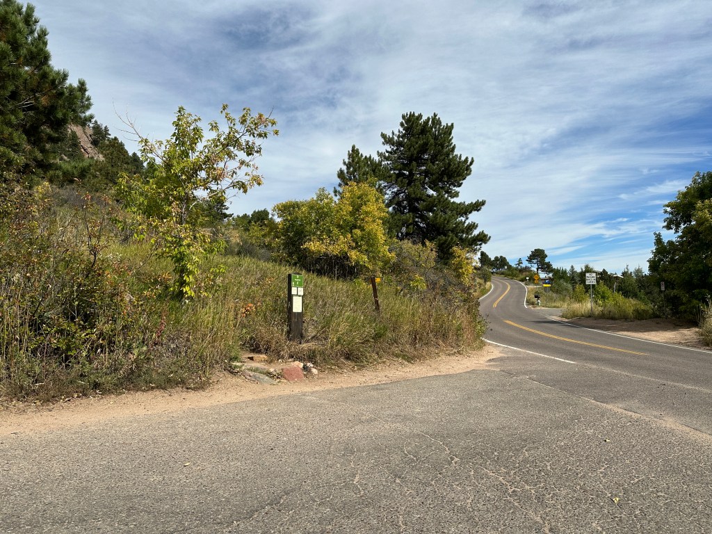
This is where I parked to begin the hike. The official parking lot at the trailhead only has about 6-8 available spots around a circle lot. You’ll need to arrive quite early to get one of those spots. If you don’t get one though, not to worry. You can also park all along the side of Gregory Canyon Road, like in the photo below (on the right). This is what I did. Parking here allows you to ascend through Gregory Canyon before reaching Flagstaff Road and Realization Point.
Directions to the Gregory Canyon Trailhead: Go west along Baseline Road. Turn left onto Gregory Canyon Road. The circle lot is at the very end of Gregory Canyon Road. You’ll see cars parked along the left side of the road. Go to the circle to turn around and find a parking spot along the road.


Reflection Point Parking
If you’re looking for a shorter and quicker way up to Flagstaff Mountain, and have no interest in ascending through Gregory Canyon, then you can park at the Reflection Point parking lot. From Realization Point, it is only a 20-30 minute walk to reach the Flagstaff Summit. There are about 20-25 parking spots here.
Directions to Realization Point: Go west along Baseline Road. Once you make the first sharp right turn, Baseline Road turns into Flagstaff Road. You’ll wind along Flagstaff Road for about 10 minutes. On the right side of the road, you’ll see a sign that says “Reflection Point: Flagstaff Summit 1/2 Mile.” There is parking along the left side of the road, or in the lot on the right side of the road.


Where to Start Hiking the Flagstaff Trail
From Gregory Canyon Trailhead Parking lot
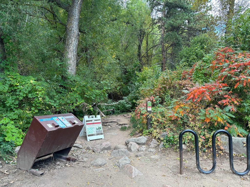
If you park at the Gregory Canyon parking lot, you’ll begin the hike at the Gregory Canyon Trailhead. When you are in the parking circle, you’ll see two paths to take. One path crosses a bridge and will take you towards Chautauqua Park. This path has a large Gregory Canyon Sign (photo below on the left). You do not want to take this path.
The trailhead actually begins next to the trashcans (photo below on the right). It can appear a little hidden depending on the season if the flora is overgrown. Very quickly the trail splits in two. Follow the smaller trail to the right to go up through Gregory Canyon. The trail to the left will take you to Saddle Rock.

From Reflection Point Parking
If you park at Realization Point, the hike is quite easy and straightforward to reach the summit of Flagstaff Mountain. You can take either the Ute Trail (to the right) or the Range View Trail (to the left). You can reach the summit of Flagstaff Boulder Colorado regardless of the direction you choose to go. They will essentially make one large loop. The trails are very well marked and it will be clear where to go.

Route Description for Gregory Canyon to Flagstaff Mountain
Gregory Canyon Hike to Realization Point
Here is a little trail snapshot of Gregory Canyon to Realization Point. When you first begin the hike at the Gregory Canyon Trailhead, you’ll want to turn right almost immediately onto a very narrow path. If you’re hiking the trail outside of winter, it can be easy to miss as there are lush bushes and trees that seem to overtake the path. You’ll feel very much in the center of nature. If you miss that turn and go left, you’ll end up on the Saddle Rock Trail.
Continue along the Gregory Canyon Trail for about 45 – 60 minutes. It will take you right up through the canyon, surrounded by trees and a fairly narrow path. Don’t forget to turn around every one in a while to see the views.


Range View Trail
Once you get to the top of Gregory Canyon, the trail will take you to Flagstaff Road where you’ll see several parking spaces. This is the Realization Point. From here, you’ll have two options to reach the top of Flagstaff Mountain. If you take the trail that goes down a bit to the left, you’ll be on the Range View Trail.
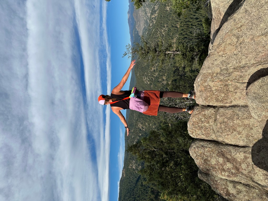
The trail that goes to the right is the Ute Trail. You can really take either trail because ultimately they’ll make a big loop. When you take the Range View Trail, you’ll be treated to some great views of the valley down below to your left. There are a few great spots to stop and take some scenic photos. The trail is a steady incline at first, but eventually smoothes out and feels pretty flat for the most part. If you want to increase the length of your hike, you can pass the summit for Flagstaff and keep going to reach the Boy Scout Trail. The end of this trail will bring you very close to the Boulder Sunrise Amphitheater.
Ute Trail
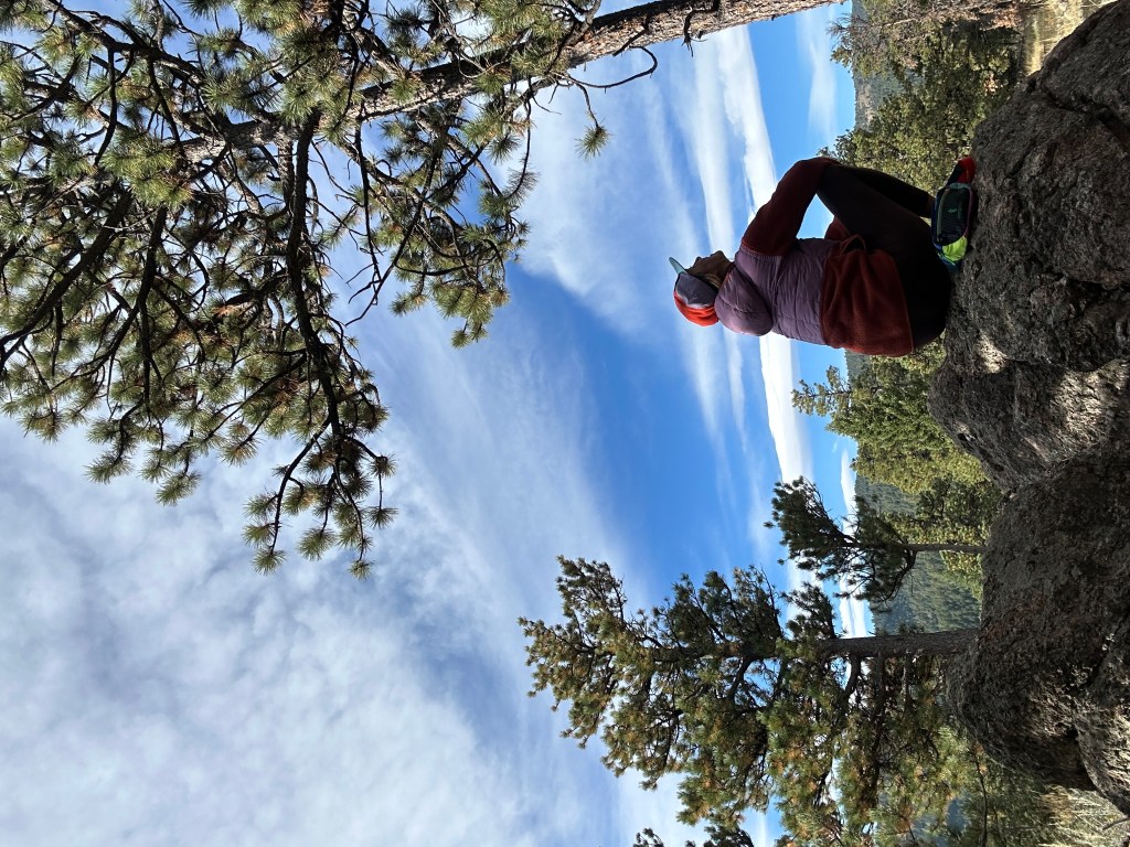
The Ute Trail begins at Realization Point. It is the trail that goes to the right of the parking. There are a few smaller Ute trails that jut off but they also form a small loop. The Ute Trail is a bit rocky but the terrain is not that difficult to navigate if you use AllTrails. One of the best viewpoints is along the Ute Trail, which is shown in the AllTrails screenshot underneath the “Is Flagstaff via Gregory Canyon a Hard Hike?” heading down below in this post.

Flagstaff Summit
I’ll be honest. This is the least impressionable peak of any mountain I’ve hiked. When you look at the trail map, it appears you will reach a summit. But when you follow the trails to get there, it leads you to a wide-open field. There are a few giant boulders right in the center that mark the peak, but other than that, it’s really underwhelming. The best views were along the Ute Trail, not at the summit like you would usually expect.


How Long is the Flagstaff via Gregory Canyon Trail?
This hike took me about 2 hours and 15 minutes total, from the parking lot, up the canyon, to the peak, and back down again. According to the AllTrails Flagstaff Mountain Summit via Gregory Canyon hike, the hike is 5.4 miles out and back. However, that is assuming you go all the way along the Boy Scout Trail. I did not. I followed the Range View Trail to the summit of Flagstaff, and then went back down on the Ute Trail, and back down through Gregory Canyon, for a total of about 4 miles.

Is Flagstaff via Gregory Canyon a Hard Hike?
I would say no, for the most part. It can get pretty steep going up through Gregory Canyon. I definitely needed to take off my jacket as I got pretty sweaty going up. But the trail was well-managed and clean. The Gregory Canyon portion is an easy to intermediate level. The Realization Point to summit portion is really quite easy. Small ascents but nothing too drastic.


What to Wear when Hiking to Flagstaff via Gregory Canyon
The Flagstaff via Gregory Canyon Trail in Boulder has a lot of varying terrain, so you should dress accordingly to protect your ankles and knees along the trail, and your face from the sun. Here are a few suggestions:
- Simple athletic shoes/hiking boots
- shorts/pants – I love Kuhl hiking pants
- Athletic top that wicks away sweat
- Light jacket if you go early in the morning or in the evening (I LOVE the Cotopaxi windbreaker)
- Fleece in the winter or early spring.
- Sunglasses
- Hat- my favorite is from Cotopaxi
What to Bring when Hiking to Flagstaff via Gregory Canyon
Check out my blog post about the best hiking gear for beginners.
The entire hike may take you 2.5-3 hours, so don’t forget these things:
- Water bottle
- Water bottle sleeve to easily carry your bottle without hands
- Sunscreen SPF
- Hip bag (for keys and things)
- SPF Chapstick
- Step counter watch
- Your phone to take photos
Insider Hints for Gregory Canyon to Flagstaff Mountain
- There is a lot of tree cover along Gregory Canyon.
- Park in the Gregory Canyon Trailhead parking lot.
- Vehicles registered outside of Boulder County must pay a parking fee.
- Park at Realization Point for an easier and quicker hike.
- Remember to bring water and SPF.
- Many great photo opportunities around. They get better as you get higher.
- Dogs are allowed in the area, but only on a leash in certain parts (check the trail map).
- Don’t forget to carry out your dog’s poo bags.
- Stand aside and let other hikers pass if they approach behind you quickly.
- Uphill hikers always have the right-of-way; stand aside for them.
- Take your trash with you. Leave no trace.
- Use AllTrails to stay on the correct route.
Are dogs allowed on the Flagstaff Trail?
Yes, dogs are allowed. There are portions of the trail where a leash is not required, but for the most part, dogs must be on a leash. The requirements change depending on the season. Please consult the trail map before hiking so you know exactly whether your dog needs a leash or not.
Are bikers allowed on the Flagstaff Trail?
No. Bicycles are not permitted on this trail.
Looking for a Longer Hike? Gregory Canyon & Flagstaff Trail Add-ons:
If you’re looking for a longer hike, here are a few suggestions of other nearby trails to add on.
Saddle Rock
When you start hiking at the Gregory Canyon Trailhead, you’ll be immediately faced with a fork in the road. Go right for Gregory Canyon, or left for Saddle Rock. The Saddle Rock trial can be as long or short as you want it to be. You can do a quick loop around if you want, or you can continue going up where it will eventually meet the EM Greenman Trail, which will take you to Green Mountain.

Flatirons 1 & 2
The First and Second Flatiron hikes are nearby. You can park at the Gregory Canyon Trailhead and cross the small bridge and head towards Chautauqua Park. Or, you can park at/near Chautauqua Park and head up from there.
Royal Arch
The Royal Arch hike also begins near Chautauqua Park and is one of the coolest hikes in the area. Click here to read more details about hiking to the Royal Arch.

Where to Eat & Drink After Hiking to Flagstaff Boulder
Chautauqua Dining Hall
If you’re enjoying your time inside Chautauqua Park, then stay for lunch at the Chautauqua Dining Hall. There is a great wrap-around outdoor balcony patio where you can enjoy your lunch with a view. They are open for breakfast, lunch, and dinner.
Alpine Modern Cafe
This cafe is just down the street on the corner of 9th St and College Ave. It is clean, modern, and sleek with a great outdoor patio where you can sip on a post-hike cappuccino.
Where to Stay in Boulder near the Flagstaff Trail
Colorado Chautauqua Cottages
Description: The cottages are located inside the Chautauqua Park, just near the base to many hikes as well as the Chautauqua Dining Hall. There is a summer concert series in the park as well. The cottages include a living room and a front porch. There is free wifi, parking, and breakfast for an additional charge.
Price: A cottage runs about $350/night in the summer months, and $200- $250 in the winter.
Hotel Boulderado
Description: This is a historic hotel in downtown Boulder, one of the town’s oldest. It’s located just one block off of Pearl Street. It is a 40-minute walk to Chautauqua Park, but you can also take the HOP (bus) counterclockwise to the stop on 9th/College (where Alpine Modern cafe is). From there it is a 10-15 minute walk to the park. There is a restaurant and bar on-site, though there are several around in the area as well.
Price: Rooms range in price from $250-$400 in the summer, and around $100 less in the winter.
St Julien Hotel & Spa
Description: This beautiful hotel and spa is located on the corner of Walnut and 9th. It’s just a couple of blocks away from the Pearl Street walking mall. It’s a 25-minute walk to Chautauqua Park, or 15 minutes on the HOP between busing and walking. This is a luxury hotel with a swimming pool, valet parking, bar/lounge, fitness center, and bicycle rentals.
Price: Rooms range from $300- $500/night. In the winter you can find deals for around $250/night.
Flagstaff via Gregory Canyon Final Thoughts
The Flagstaff via Gregory Canyon Trail is a fantastic hike to do when you want to really feel yourself in nature. I saw very few people going up through Gregory Canyon so I felt a lot of solitude. The portion from Realization Point to the summit of Flagstaff definitely had a lot more people around. This isn’t one of my favorite hikes in Boulder honestly, but it’s a great one to do if you have a few hours and just want to get out and breathe fresh air. It’s very accessible and easy to reach from town.


TRAVELING SOON?
INSURANCE: Cover yourself with travel medical insurance by SafetyWing.
FLIGHTS: Get the best flight deals with Skyscanner and set flight alerts with Hopper.
STAYS: Check out hotels and apartments with Booking.com and Vrbo.
RENTAL CARS: Get the best deal on rental cars with Discover Cars or RentalCars.
GOING HIKING? Get a 30% discount off your yearly AllTrails+ Account (code: nickiposts30)
eSIM: Get an international eSim with Airalo.
CITY GUIDES: Save time and purchase pre-made city guides with Thatch.
CITY TOURS: Book your tour with GetYourGuide and Viator
LUGGAGE: Get the best carry-on suitcase here.
CREDIT CARD: Start earning travel points with the best travel credit card.
BUENOS AIRES GUIDE: Purchase my Buenos Aires travel companion here.
CONSULTATION: Book a 1:1 travel consultation with Nicki here.
SUBSCRIBE: Get the Nicki Posts Travel Stuff newsletter every month.
TRAVEL BETTER: Check out my Travel Tips and best Travel Resources pages.
MORE? Check out more on my LINKS page to find me in more places!


You must be logged in to post a comment.