11 Exciting Hikes Near Boulder Colorado
Exciting Hikes Near Boulder Reading Time: 19 minutes
As someone who grew up in Boulder County, I know the area quite well. However, after returning to Colorado after many years abroad, I realized I did not know the local hikes as well as I would like. So I spent the entire summer and fall in Boulder trying out as many hikes near Boulder as I could. Below is a list of the 11 best and most exciting hikes near Boulder for all skill levels.
The following 11 hikes near Boulder are listed in subjective order, with my favorite hike at the very end.
View this list in the AllTrails app for 11 Exciting Hikes near Boulder CO.
I use AllTrails Plus when I go hiking. I highly recommend it as you can download offline maps, and send out “lifelines” to friends and family to let them know exactly where you are. You can rate trails, and get inspired to try new ones. The membership is $35/year, but with this discount, it is just $25 for the year. That’s barely $2/month.
Click here to get 30% OFF of your own AllTrails Plus account
Use code: nickiposts30
Hike near Boulder: Red Rocks Spur Loop
Click here to read my full blog post about hiking the Red Rocks Spur Loop.

Why I love this hike near Boulder
The Red Rocks Spur Loop is low effort, high reward. If you’re looking to get out into nature, but perhaps not in the mood for a big challenge, this hike is where it’s at. You can do the entire loop in just 30 minutes if you really want to. Or you can take your time, admire the views, climb the rocks, and breathe in the fresh air. This is a great hike to bring kids to as it is not very difficult, and they’ll also love playing on the rocks up top.
Red Rocks Spur Loop Difficulty Level
This hike is not difficult. There are a few steep inclines at the beginning and closer to the top, but overall, it’s very painless.
Red Rocks Spur Loop Trailhead
The Red Rocks Spur Loop Trailhead starts just next to the People’s Crossing parking lot. It’s very easy to find. Just follow Pearl Street west from downtown, and go until it dead ends at the People’s Crossing Parking lot. Easy peasy.
Hike near Boulder: Anemone Loop
Click here to read my full blog post about hiking the Anemone Loop.

Why I love this hike near Boulder
The Anemone Loop Trail is one giant circle with very few ascents and descents. If you just feel like walking in nature, without a big commitment, this is the perfect hike. You can get some great views all around the loop. If you have a dog, it’s a perfect walking spot. I also love that there are so many other trails in the area, so you can easily add on to this to make it longer if you’re in the mood for that.
Anemone Loop Difficulty Level
This hike is easy. There were no points I felt winded or tired. You just have to be prepared for the sun in the hotter months, as there are several wide-open portions to the hike with minimal tree coverage.
Anemone Loop Trailhead
The Anemone Loop Trailhead begins in the center between Mapleton Avenue and Canyon Drive. Therefore, you can begin on either side that you want. Park in the People’s Crossing parking lot along Canyon (end of Pearl Street) and go north, or the Centennial Trailhead parking lot along Mapleton Avenue and walk south. You’ll find the Anemone Loop Trailhead at a junction along the Red Rocks Trail, just below the red rocks.
Hike near Boulder: Lion’s Lair
Click here to read my full blog post about hiking to Lion’s Lair.

Why I love this hike near Boulder
I love this trail because it offers an alternative to reaching Mount Sanitas. Sometimes the Sanitas Trail can get really crowded, and it’s also very steep. So if you still want to reach the summit of Sanitas, but don’t want to scramble up rocks and sweat too much, then the Lion’s Lair hike is ideal.
Lion’s Lair Difficulty Level
I would say this is a moderate hike. There are definitely a few steep ascents but for the most part, it consists of a ton of switchbacks and is totally manageable.
Lion’s Lair Trailhead
You can park at the Lion’s Lair Trailhead which is about 10 minutes past the Mount Sanitas Trailhead along Mapleton Avenue. However, there are not a ton of parking spots there. If you can’t manage to find a spot, or if you want to extend your hike, park at the Centennial Trailhead along Mapleton Avenue. From there, hike the Sunshine Canyon Trail until you reach Mapleton Avenue. Then cross the street and go up a set of wooden stairs, and you’ll find the Lion’s Lair Trailhead.
Hike near Boulder: Flagstaff via Gregory Canyon
Click here to read my full blog post about hiking to Flagstaff.

Why I love this hike near Boulder
I love the portion that goes up through Gregory Canyon. It’s really beautiful, especially in fall when all the leaves are changing colors. Also, there don’t tend to be a lot of people along Gregory Canyon so you really get the place to yourself. While Gregory Canyon is a less populated trail, Flagstaff Mountain does tend to be one of the more well-known hikes near Boulder. So once you cross Flagstaff Road, you should expect to find more people around along the Ute Trail and Range View Trail.
Flagstaff via Gregory Canyon Difficulty Level
You’ll definitely work up a sweat hiking the ascent through Gregory Canyon. There are several parts of the trail that are narrow and full of rocks, but still pretty manageable. This is a solid intermediate hike. Once you cross Flagstaff Drive and hike along the Ute Trail or Range View Trail, it’s pretty easy.
Flagstaff via Gregory Canyon Trailhead
There are a couple of places to park to reach the summit of Flagstaff. If you want to reach the summit only and skip the entire Gregory Canyon portion, then you can park at Realization Point; just follow Baseline Road west for about 10 minutes and you’ll see some parking.
If you do want to hike Gregory Canyon (you should!), then park at the Gregory Canyon Trailhead. There are only a few parking spots around the circle, but you can also park along Gregory Canyon Road. It’s very easy to find. Just go west along Baseline Road for a couple of minutes. Turn left onto Gregory Canyon Road and voila, you’re there!
Hike near Boulder: First & Second Flatirons
Click here to read my full blog post about hiking to the First & Second Flatirons.
Why I love this hike near Boulder
I love this hike because it is an easy-moderate hike so it’s great if you just want to be in nature without a big challenge. You can do this hike all year round, but you may need to bring some spikes in the winter months. There are great views at several points along the trail, but the very top point of the hike offers amazing views.
First & Second Flatirons Difficulty Level
I was surprised at how easy I found this hike to be. Technically it’s considered to be moderate, but I found it pretty easy.
Flatirons Trailhead
I suggest parking at Chautauqua Park or the surrounding neighborhoods. From there, begin hiking along the Chautauqua Trail. That will eventually lead you to the Flatirons trailhead. It’s well-marked. The Flatiron’s trail is an out-and-back, but you can make a loop out of the bottom part of the trail. Go back via the Bluebell trail rather than the Chautauqua Trail.
Hike near Boulder: Mount Sanitas
Click here to read my full blog post about hiking to Mount Sanitas.
Why I love this hike near Boulder
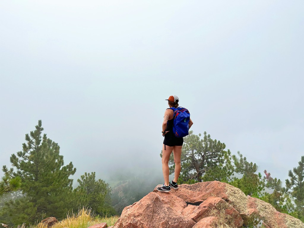
Mount Sanitas has long been one of my favorite hikes in Boulder. I spent many Saturday mornings on its rocky paths back in my college days. I even had a field trip here back in the 8th grade. I love hiking Mount Sanitas because it’s a real challenge. It’s steep and rocky, and in many places, you have to scramble a bit. It’s also quite popular, so you’ll rarely find yourself alone along this path. Once you reach the peak you’ll be treated to one of the best views looking over Boulder. Unless it’s super foggy like it was the day I took that photo above.
Mount Sanitas Difficulty Level
The Mount Sanitas Trail is pretty difficult. You might struggle if you have knee issues or you’re not fully adjusted to the Colorado altitude. It gets steep fast. If you want to reach the summit of Mount Sanitas, but don’t want the challenge of the Mount Sanitas Trail, then you can take either the Lion’s Lair Trail or the East Ridge Trail up.
Mount Sanitas Trailhead
The Mount Sanitas Trailhead can be found along Mapleton Avenue. There are a few parking spots along Mapleton where you can leave your car if you’re lucky. If those spots are taken, you can either park in the Centennial Trailhead lot across the street or in the residential neighborhood streets.
Hike Near Boulder: Green Mountain via Saddle Rock
Click here to read my full blog post about hiking to Green Mountain.

Why I love this hike near Boulder
I love this hike because you can make one big loop, rather than it being just an out-and-back trail. You have the chance to constantly see new scenery. It is definitely a challenge to do this hike, but you can choose which way up and which way down you want to go. You can also decide how long you want the hike to be: park at Realization Point, or park down below at the Gregory Canyon parking lot and go up either the Saddle Rock Trail or Gregory Canyon. Green Mountain is one of the top 5 highest peaks in Colorado, making it one of the most challenging hikes near Boulder.
Green Mountain via Saddle Rock Difficulty Level
This hike is pretty difficult. Both Saddle Rock and Gregory Canyon are fairly steep. But if I had to compare, I would say going up Saddle Rock is slightly more difficult than Gregory Canyon. Either way, there will be lots of steep sections and rocky paths to go up.
Green Mountain via Saddle Rock Trailhead
The best place to park is at the Gregory Canyon Trailhead and go up from there. It’s a big loop, so you can choose whether you would rather go Gregory Canyon first, or the Amphitheatre Trail & Saddle Rock Trail first. It is pretty steep whichever way you choose, but Saddle Rock is just slightly steeper.
You can also reach Green Mountain by parking at Realization Point, along Flagstaff Road, and taking the Ranger Trail over to the Green Mountain Trail.
Hike near Boulder: Mallory Cave
Click here to read my full blog post about hiking to Mallory Cave.

Why I love this hike near Boulder
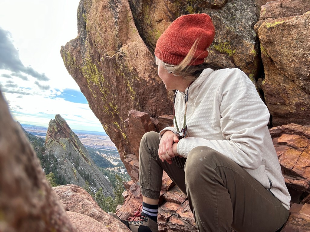
I can’t say enough positive things about this hike. I love it so much. It’s a great hike all the way up. It definitely gets steep in parts, but it’s worth it. Once you reach the top, the views are completely worth it. You’ll be treated to spectacular views of both the Flatirons and Boulder down below. The Mallory Cave hike is now easily one of my absolute favorite hikes near Boulder.
Note that you cannot hike all the way to the caves in the summer months. The cave is closed from April 1 to October 1.
Mallory Cave Difficulty Level
This is an intermediate hike. It is steep in parts, and several parts of the trail are quite narrow and rocky.
Mallory Cave Trailhead
The trail to reach Mallory Cave begins at NCAR. There are a ton of parking spots at NCAR. From there, follow the NCAR trail up to the water tank. From there, keep going and you’ll start to see the signs for Mallory Cave.
Hike near Boulder: Royal Arch
Click here to read my full blog post about hiking to the Royal Arch.

Why I love this hike near Boulder
I love the Royal Arch hike because it’s a fairly quick ascent (about one hour), and then has amazing views once you reach the top. This is easily one of my favorite hikes near Boulder. There are a ton of great photo opportunities. There were quite a lot of people on the trail so you should not expect to feel isolated in nature.
Royal Arch Difficulty Level
This is an intermediate hike. There are several sections that are narrow and rocky. It is also a fairly steady and steep ascent going up to reach the Royal Arch.
Royal Arch Trailhead
The start of the trail is in Chautauqua Park. Take the Bluebell Trail up to the left. Once you reach the shelter, you’ll start to see the trail signs for Royal Arch. It’s not free to park at Chautauqua Park. You can park along Baseline Road which is free between Labor Day and Memorial Day.
Hike near Boulder: South Boulder Peak
Why I love this hike near Boulder
I love this hike because it is the highest peak in all of Boulder, and you can easily combine it with Bear Peak on the same day. It is only 30 minutes from peak to peak. You have a choice of going up along the Bear Peak Trail (challenging), or going up through Shadow Canyon. This is one of the most necessary hikes near Boulder because it is the highest peak around.
Bear Peak via Shanahan Ridge Difficulty Level
If you go to Bear Peak first (hike mentioned above), then this hike is quite difficult. The hike between the peaks is really not challenging, but getting up to Bear Peak is pretty difficult. If you choose to take Shadow Canyon, then it becomes more of an intermediate hike.
Bear Peak via Shanahan Ridge Trailhead
If you want to go up the more challenging Bear Peak Trail, I suggest parking at the Cragmoor Trailhead in the residential neighborhood. If you prefer to go up via Shadow Canyon, then you can park at the South Mesa Trailhead.
Hike near Boulder: Bear Peak via Shanahan Ridge
Click here to read my full blog post about hiking to Bear Peak.

Why I love this hike near Boulder
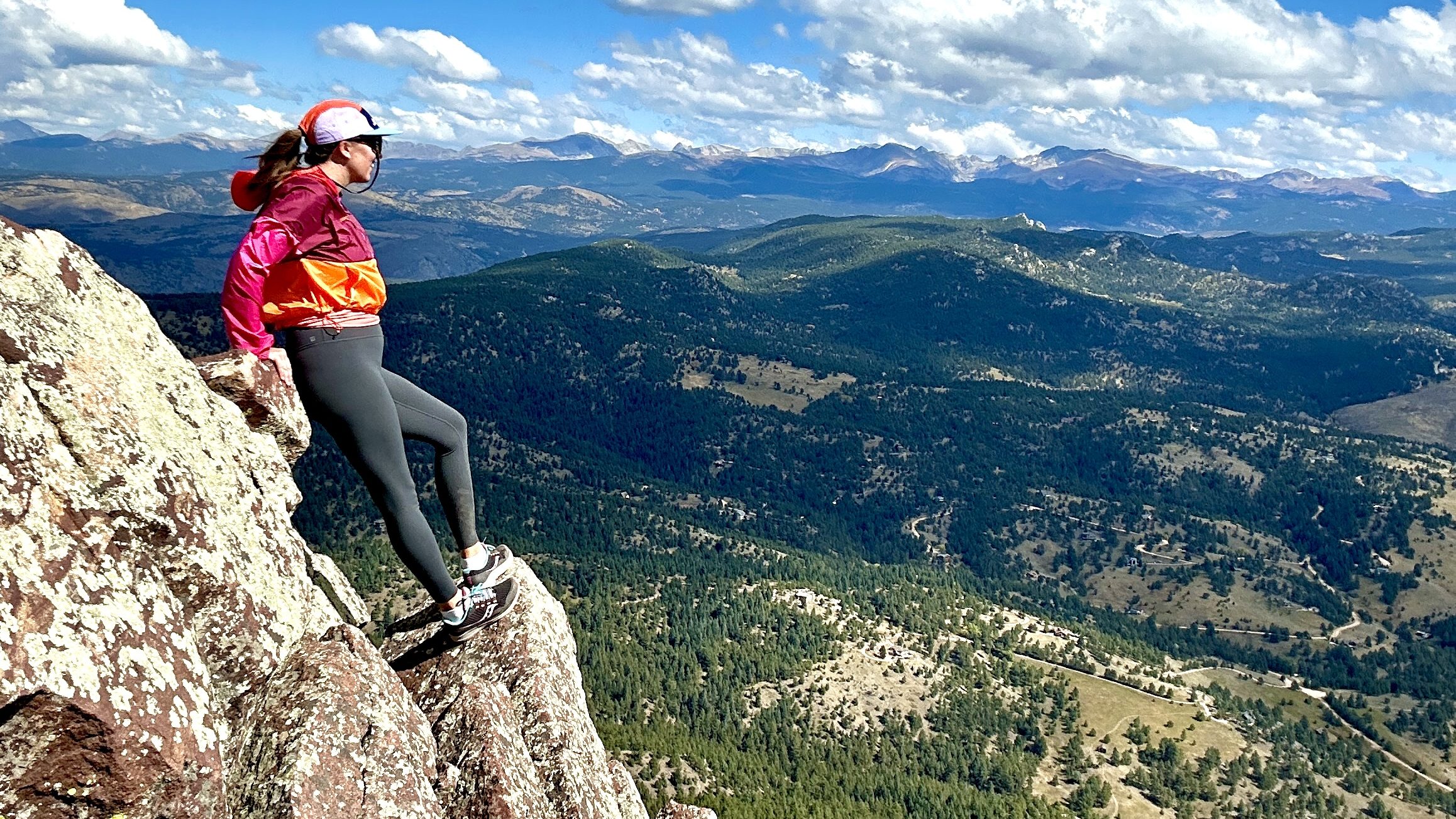
This hike has one of the absolute best summits in all of Boulder. It’s not just a lookout spot, but a rocky summit that truly makes you feel like you’re on top. You can get 360 views from the summit of Bear Peak. The hike up is also pretty amazing; don’t forget to turn around and look behind you every once in a while.
Bear Peak via Shanahan Ridge Difficulty Level
It is a difficult climb up to Bear Peak. The first portion of the hike along Shanahan Ridge is fairly easy with just a slow ascent. The middle portion is where things start to get slightly more challenging. There are narrow paths and lots of rocks to climb up and over, and you’ll find yourself sweating. You really need to save yourself for the last hour though. It’s essentially straight up and very steep. It’s one of the hardest hikes in Boulder, but also one of the very best!
Bear Peak via Shanahan Ridge Trailhead
You can park at NCAR and work your way up to Bear Peak if you take the NCAR Trail to the Mesa Trail (south), which will eventually meet up with the Bear Peak Trail. However, I recommend parking in the neighborhoods near the Cragmoor Trailhead.
Where to Stay in Boulder
Colorado Chautauqua Cottages
Description: The cottages are located inside the Chautauqua Park, just near the base to many hikes as well as the Chautauqua Dining Hall. There is a summer concert series in the park as well. The cottages include a living room and a front porch. There is free wifi, parking, and breakfast for an additional charge.
Price: A cottage runs about $350/night in the summer months, and $200- $250 in the winter.

Hotel Boulderado
Description: This is a historic hotel in downtown Boulder, one of the town’s oldest. It’s located just one block off of Pearl Street. It is a 40-minute walk to Chautauqua Park, but you can also take the HOP (bus) counterclockwise to the stop on 9th/College (where Alpine Modern cafe is). From there it is a 10-15 minute walk to the park. There is a restaurant and bar on-site, though there are several around in the area as well.
Price: Rooms range in price from $250-$400 in the summer, and around $100 less in the winter.
St Julien Hotel & Spa
Description: This beautiful hotel and spa is located on the corner of Walnut and 9th. It’s just a couple of blocks away from the Pearl Street walking mall. It’s a 25-minute walk to Chautauqua Park, or 15 minutes on the HOP between busing and walking. This is a luxury hotel with a swimming pool, valet parking, bar/lounge, fitness center, and bicycle rentals.
Price: Rooms range from $300- $500/night. In the winter you can find deals for around $250/night.
Fairfield Inn & Suites Boulder
Description: This hotel is located on South Boulder Road (Table Mesa) just next to the Highway 36 onramp. There is free parking, fitness center, and wifi. Continental breakfast is included.
Price: Rooms range in price from $160-$220 in the summer, and around $130-$200 in the winter.
Foot of the Mountain Motel
Description:This motel is located just next to Eben G Fine Park and about a 5-minute walk from the Red Rocks Spur Loop trailhead. Bike rentals are also available. Breakfast is included. One free parking space is allotted to each room. This place is highly recommended by friends who have stayed here.
Price: Rooms are around $200 – $300/night in the summer and can go as low as $125/night in the winter.
Boulder Adventure Lodge
Description:This is a self-described “convening point for the outdoor-minded.” This is a hostel and community space that offers private rooms as well as dorm beds, though the hostel room is specifically for out-of-state travelers.
Price: A bed in the hostel dorm room runs about $60/night, while the private rooms can go from anywhere between $200-$300/night.
Where to Eat and Drink in Boulder
Alpine Modern Cafe
This cafe is just down the street on the corner of 9th St and College Ave. It is clean, modern, and sleek with a great outdoor patio where you can sip on a post-hike cappuccino.
Address: 904 College Ave, Boulder, CO 80302
Southern Sun
You can find the Southern Sun at the corner of Table Mesa and Broadway, set slightly back from the main street. This is a brewery and restaurant with great beers and food. You can only pay in cash. No credit cards.
Address: 627 S Broadway Ste E, Boulder, CO 80305
Avery Brewing
This is a fantastic destination brewery, located in Gunbarrel. It is easily one of the oldest and most well-known breweries in Boulder. Avery has a full kitchen, cool staff, and 30 taps of incredible beer on draft.
Address: 4910 Nautilus Ct N, Boulder, CO 80301
Sherpa’s Adventure Restaurant and Bar
This is a lovely restaurant with fantastic outdoor seating where you can enjoy the warm air and delicious chai tea. Oddly enough, it’s also a great place to watch a game. They have a TV and a small bar inside that is perfect for a cozy gathering for sports fans.
Address: 825 Walnut St, Boulder, CO 80302
10 Exciting Hikes Near Boulder: Final Thoughts
There are so many hikes near Boulder that you can choose from. These are just my top ten favorites, from the easy to the very challenging. Regardless of your mood or fitness level, Boulder has a hike for everyone. I hope that this blog post has been helpful in your planning process.
Happy Hiking!
TRAVELING SOON?
INSURANCE: Cover yourself with travel medical insurance by SafetyWing.
FLIGHTS: Get the best flight deals with Skyscanner and set flight alerts with Hopper.
STAYS: Check out hotels and apartments with Booking.com and Vrbo.
RENTAL CARS: Get the best deal on rental cars with Discover Cars or RentalCars.
GOING HIKING? Get a 30% discount off your yearly AllTrails+ Account (code: nickiposts30)
eSIM: Get an international eSim with Airalo.
CITY GUIDES: Save time and purchase pre-made city guides with Thatch.
CITY TOURS: Book your tour with GetYourGuide and Viator
LUGGAGE: Get the best carry-on suitcase here.
CREDIT CARD: Start earning travel points with the best travel credit card.
BUENOS AIRES GUIDE: Purchase my Buenos Aires travel companion here.
CONSULTATION: Book a 1:1 travel consultation with Nicki here.
SUBSCRIBE: Get the Nicki Posts Travel Stuff newsletter every month.
TRAVEL BETTER: Check out my Travel Tips and best Travel Resources pages.
MORE? Check out more on my LINKS page to find me in more places!


You must be logged in to post a comment.